
Walk a Santa Rosa Street by Address
In Santa Rosa, an address search works best as a chain of joins. Start with the full street address and treat the returned fee parcel or APN as the key that ties a place to maps, assessment facts, permits, and recorded instruments. Confirm whether the parcel is inside incorporated Santa Rosa before selecting a permit office. Then use the assessed-owner roll, recorder party index, and historical or voter sources in separate passes. Ownership, a recorded party, voter registration, and a directory listing are different kinds of evidence.
A postal city can remain Santa Rosa even when the parcel is outside the city boundary, including former county islands. The city parcel report can direct an address to Permit Sonoma, while incorporated parcels use Santa Rosa systems. Keep the legal description with the APN because parcel numbers can change after a split or merger. This Santa Rosa routing order preserves the trail and makes a dead end informative.
- Address. For a Santa Rosa address, enter the street address in Sonoma County Assessor Parcel Search, selecting STREET ADDRESS. Save the situs address, fee parcel or APN, parcel information, value notices, and map link.
- Jurisdiction and GIS. Use Santa Rosa GIS for incorporated parcels and the Sonoma County GIS Hub for county coverage. For Santa Rosa parcels, check jurisdiction before treating a map layer or permit result as controlling.
- Office roll. Take the APN to the Assessor office roll when an assessed owner or mailing fact is necessary. The Santa Rosa Internet result omits owner names, and the roll is not proof of occupancy.
- Recorder party index. For a Santa Rosa parcel, search the assessed name in the Official Public Records index, starting near the likely recording year. The recorder index is party-name based, so the parcel supplies the name bridge.
- Deed. Open or request the identified Santa Rosa instrument, then compare the grantor, grantee, recording date, document number, and legal description. Use the legal description to follow the same land if the APN changed.
- Voter limits and directories. For Santa Rosa street research, My Voter Status is an identity-authenticated self-lookup, not a public street list. Historical directories, newspapers, census schedules, and permits add time or place context without becoming a complete resident list.
Search Santa Rosa Parcels by Street
For Santa Rosa parcels, the Sonoma County Assessor Parcel Search is the first address-keyed stop. Its search modes are narrow: FEE PARCEL, ASSESSMENT, or STREET ADDRESS. The address route returns parcel number and basic parcel information, assessment-roll data, assessed-value change notices, Proposition 8 notices, and a parcel map. It does not provide an Internet owner-name search.
The Sonoma County Assessor Parcel Search screen makes the three Santa Rosa search modes visible before a query is run.
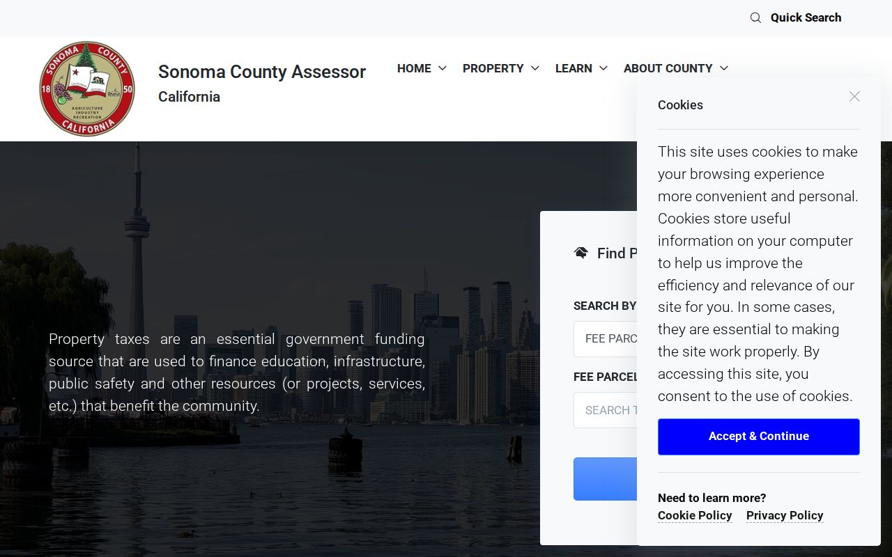
The free Santa Rosa public screen establishes an APN and situs, not a complete household record, legal title opinion, or proof that a named person occupies the parcel.
| Field Label | Type | Required | Options / Format Notes |
|---|---|---|---|
| SEARCH BY | Dropdown | Yes | FEE PARCEL (default); ASSESSMENT; STREET ADDRESS |
| FEE PARCEL / Assessment / Address | Text | Yes | Dynamic label; for address searches omit Street, Road, Drive, and Lane; use W for West |
| Search | Button | Not applicable | Executes the selected mode |
| Quick Search | Text | No | Accepts a FEE PARCEL value |
| Cancel | Button | Not applicable | Clears or returns |
For Santa Rosa searches, the field label changes with the selected mode. Address tips say to omit Street, Road, Drive, and Lane, while West should be entered as W. Maps update monthly, and roll data reflects the most recently published roll. The linked map supports assessment work; it does not establish a legal parcel or building site.
At the Santa Rosa office counter, assessment records may be viewed free and copies purchased. The roll can supply an assessed owner and, where present, tax-mailing information. Situs is the physical parcel address; mailing is where tax correspondence goes. A mismatch may suggest that notices go elsewhere, but it does not identify private occupants.
Santa Rosa Street Records in One View
Santa Rosa streets rarely appear as one clean roster. Each custodian records a different event or status, and the strongest address trail joins sources by APN, document number, date, legal description, or issue year. The assessor supplies parcel facts, the map supplies geography, permits supply project history, the recorder supplies named parties to instruments, and directories or census schedules supply historical household context.
| Record Set | Keeper | Address Link | Access |
|---|---|---|---|
| Assessor Internet | Sonoma County Assessor | Santa Rosa situs, APN, values, notices, parcel map; no owner names | Free Santa Rosa online search |
| Assessment roll | Sonoma County Assessor | Santa Rosa assessed owner and roll or mailing facts | Free viewing and copies at office |
| Santa Rosa GIS | Santa Rosa or Sonoma County | Parcel geometry, jurisdiction, available planning layers | Free maps; coverage varies |
| Santa Rosa Official Public Records | Sonoma County Clerk-Recorder | Santa Rosa indexed parties, instrument type, date, document number | 1964-present online; earlier indexes and office channels |
| Santa Rosa permit records | Santa Rosa or Permit Sonoma | Santa Rosa address, type, status, dates, and public documents | Free basic city search; county route for unincorporated parcels |
| Santa Rosa directories and census | Sonoma Library, NARA, and library databases | Listed occupant, business, or household at an issue or census date | Digital, in-library, or public schedules through 1950 |
| Santa Rosa voter records | California Secretary of State or Sonoma Registrar | Santa Rosa user's own registration or authorized file data | Self-lookup or restricted request, not a public street list |
The chain is not proof of a current Santa Rosa resident list. For Santa Rosa records, a permit can name an applicant, a deed can name parties, a directory can list an occupant from a past issue, and the voter self-tool only confirms the person who authenticates. On a Santa Rosa street, record the source and date beside every Santa Rosa result.
Note: An address-keyed source can show a parcel or event without identifying every person connected with the property.
Santa Rosa Address Terms That Matter
Santa Rosa address records use terms that sound interchangeable but are not. Santa Rosa research is easier when the physical place, assessment key, map geometry, and deed description remain separate. These are joins, not proof that a person resides at the site.
- APN
- An assessor parcel number used to join Santa Rosa parcel, map, roll, and permit records. It can change after a split or merger.
- Parcel
- A unit recognized in assessment and land records, not a household or resident list.
- Situs address
- The physical location of a Santa Rosa parcel. It differs from the mailing address used for tax correspondence.
- Legal description
- The deed language that identifies Santa Rosa land. It controls when a street label or APN shifts.
- Plat
- A recorded map of lots, streets, and related land divisions.
- Criss-cross directory
- A reverse directory arranged by address. No exhaustive official Santa Rosa reverse run was verified.
An APN can change after a subdivision or merger, while a legal description may preserve continuity. For an older Santa Rosa parcel, copy the lot, block, subdivision, map, or metes-and-bounds wording exactly as printed before comparing it with a current Santa Rosa parcel record.
Follow Santa Rosa GIS Parcel Layers
GIS turns a named street into a sequence of parcels. Santa Rosa's GIS maps and documents are the city route for incorporated parcels. The Sonoma County GIS Hub and ActiveMap route are useful for county geography, but county layers can chiefly describe unincorporated Sonoma County. In Santa Rosa, use the map to confirm parcel geometry, jurisdiction, and available planning context, then inspect the subject and adjacent parcels one at a time.
The Santa Rosa GIS maps and documents provide the city-side map route for incorporated Santa Rosa parcels.
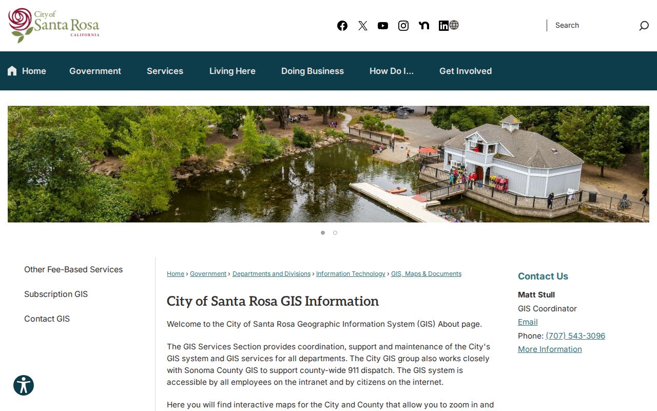
The Santa Rosa map is a geographic bridge to the assessor, not an owner directory. Layer coverage varies, and a displayed boundary should not replace a deed's legal description.
Map browsing is practical for a Santa Rosa whole-street review. Start at the address, note the APN, inspect the parcel polygon, and move along the same road. If a Santa Rosa parcel sits outside the city, switch from city permit tools to county coverage and Permit Sonoma. Exact live-map popup or export behavior was not fully exposed in the research, and no verified buffer or radius control should be promised.
Roseland's Santa Rosa Street Boundary
Roseland is the clearest Santa Rosa address lesson because postal identity and municipal jurisdiction can coexist in one record trail. Beginning in 2013, the city pursued annexation of about 714 acres in five formerly unincorporated islands: Roseland, Victoria Drive, West Hearn Avenue, Brittain Lane, and West Third Street. The official address list shows Santa Rosa mailing city and ZIP Codes 95401 or 95407 before incorporation.
The City of Santa Rosa Roseland annexation account documents the five-island geography behind that routing problem.
A street directory that uses only the city line or ZIP can send a Santa Rosa parcel to the wrong custodian. Use the city parcel or GIS result to determine incorporation. Incorporated parcels route to Santa Rosa's permit systems; county tools and Permit Sonoma cover unincorporated parcels.
The same check matters at other Santa Rosa county edges. Keep the jurisdiction result beside the APN before searching permits or interpreting county land-use layers.
Note: A Santa Rosa ZIP and mailing city can coexist with county jurisdiction, so routing must follow the parcel.
Search Santa Rosa Permits by Address
Permit Santa Rosa adds a project layer to the Santa Rosa street directory. Basic public searching does not require registration. The older search form accepts an address, permit number, title, type, subtype, status, location, and date range. A broad date range helps when older work is not returned by a default window. A permit applicant or project contact is not automatically a household member.
The Permit Santa Rosa search exposes the following fields and status choices.
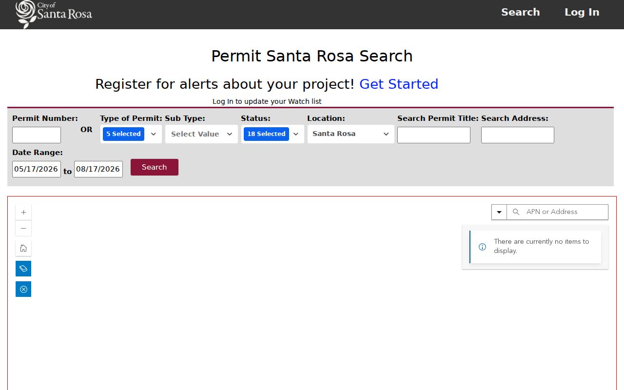
The screenshot connects the Santa Rosa address search to the Santa Rosa permit fields below, including the location and status filters.
| Field Label | Type | Required | Options / Notes |
|---|---|---|---|
| Permit Number | Text | No | Direct identifier; alternative to filters |
| Type of Permit | Multi-select | No | Building; Engineering; Fire; Planning; Water |
| Sub Type | Multi-select | No | Annexation pre-zoning; historical receipt; residential addition; demolition; electrical; mechanical; new; plumbing; pool; grading; short-term rental hosted/non-hosted; subdivision/map; tree removal; variance; water; zoning |
| Status | Multi-select | No | Not Started; Application; Initiate Yearly Inspection; Intake; Inspections; Investigation; Review; Hearing Action; Hearings; Issued; NRP Review; Permit; Appeal; Decision; Enforcement Action; Inspection; Record Drawings; Closed |
| Location | Select | No | Santa Rosa; Council Districts 1-7; Tubbs Fire Zone |
| Search Permit Title | Text | No | Title keyword |
| Search Address | Text | No | Address-keyed history |
| Date Range | Two dates | No | Widen the default when searching older work |
The newer Accela Citizen Access portal adds Santa Rosa modules for Building, Enforcement/Open Cases, Engineering, Property Information, Fire, Planning, Recreation and Parks, Water, provider, licensee, food-facility, certified-business, and geographic document searches. An account is needed to pay, apply, and use all services. If a public city record is not in the permit result, check the Santa Rosa City Records Index before using the CPRA request route. For a county parcel, city results are not a substitute for Permit Sonoma. A city parcel report for APN 058-033-014 demonstrates that routing rule by identifying the parcel as outside city limits.
Santa Rosa Deeds Past the 1964 Cutoff
Once the address supplies an assessed name, move to Santa Rosa's Sonoma County Official Public Records index. The ordinary online index begins in 1964 and is party-name based. Search guidance uses party, approximate recording year, recording date, document number, and document title. Newer deeds may carry APNs, but the legal description controls. The index points to an instrument like a library card catalog, not proof of every term inside it.
Pre-1964 is a different Santa Rosa access path, not a blank gap. The digitized grantor-grantee index is labeled 1830-1963, while county descriptions say office volumes reach back to 1835. Recorded documents from 1835-1979 survive on microfilm and digital images, and 1980-present images are on computer. A cumulative Santa Rosa map index at the office covers subdivision maps, parcel maps, surveys, and assessment districts.
Santa Rosa historic name searching needs variants. From 1964 through 1990, the first word of a name was abbreviated. From 1990, later words might still be abbreviated. Beginning January 1, 2010, staff stopped abbreviating unless the instrument itself used an abbreviation. Test full names, likely shortened forms, and business variants. The recorder does not conduct title research, so a copy request should identify the document number.
Santa Rosa online download for an identified 1964-present document costs $4 per document plus a $2 card convenience fee per transaction. Counter images and maps are free to view; copies cost $5 per page, certification costs $4 per document, and card convenience is $2.50. Email is available for 1964-present documents under 10 pages at $6 per document; pre-1964 email is $6 per page and cannot be certified. An online certified-mail order is also available for an identified document, with $4 per document certification plus copy and order charges shown by the system. Mail requires the document number and costs $5 per page plus $4 certification. The Santa Rosa recorder is at 585 Fiscal Drive, Room 103, Santa Rosa, 707-565-3800.
Santa Rosa official record copy instructions describe the counter, online, email, certified-mail, and mail channels. The recorder fee schedule should be checked before payment.
Note: For Santa Rosa deed work, the recorder can point to an instrument, but it does not choose the right record or perform title research.
Read the Santa Rosa Street Grid Through Time
Santa Rosa street text is an historical clue, not a fixed key. Santa Rosa's original 1853 rectangular plan centered on the plaza that became Courthouse Square. The 1854 plat covered roughly First through Fifth Streets, with Morgan Street west to just beyond E Street east. Later additions and subdivisions made the grid less simple, while Third, Fourth, and Mendocino remained downtown axes. Those Santa Rosa downtown axes sit within a street history shaped by the railroad, which reached the city in 1870; Railroad Square was the busiest part of town by 1888.
The 1906 earthquake destroyed downtown buildings, including photographer John Ross's Fifth Street studio. A Santa Rosa business address can disappear because of a move, rebuilding, a publication gap, or changed street context. No authoritative citywide street-renumbering year is documented in the available sources. Do not assign one. Compare the printed address, legal description, Santa Rosa map sheet, parcel history, and Santa Rosa nearby landmarks instead.
Note: A guessed renumbering date is weaker than a matching legal description, map sheet, parcel history, and nearby landmark.
Pair Santa Rosa Streets With Sanborn Maps
Santa Rosa Sanborn fire-insurance maps add structure-level context to a Santa Rosa address trail. The History and Genealogy Library local-history holdings include local hard copies, and the FIMo database supplies another route. Verified Santa Rosa map years are 1893, 1897, 1908, and 1954/1957. The sheets can show building footprint, use, construction details, and address continuity.
Santa Rosa assessor aerial photographs add later snapshots. The local holdings list 1961, 1971, 1980, a page reference to 1900 that should be verified as a possible typo, and 2000. Comparing a Santa Rosa map sheet, aerial image, Santa Rosa permit record, and directory address can show when a structure or street edge changed. It still cannot establish who occupied the building on a given day.
Use a Santa Rosa Street Directory for History
Historical Santa Rosa street directory work fills the time gap left by current portals. Sonoma County Library's digitized collection spans a broad range from the 1870s into the early 1950s, with full or partial residence, business, and telephone directories. The Polk-Husted Santa Rosa, Petaluma and Sonoma County directory is available for 1909-10, a Press Democrat directory covers 1924, and Pacific Telephone and Telegraph issues cluster from 1921 through the 1930s. Search the digitized Sonoma County directories for Santa Rosa issue pages by item, then inspect the scanned page because OCR can misread surnames, initials, and abbreviations.
Use the Santa Rosa alphabetical and business sections first. Record the printed name, occupation, business relationship, street address, and issue year. Local Santa Rosa samples show Julius F. Scholz at 410 Fourth Street in 1903, at 323 Fifth in 1908, partnered with William McClearie in 1911-13, and owning a gallery in 1915-20. The 1918 volume lists Fred Hartsock, photographer, at 523 Fourth Street. These Santa Rosa entries show movement or business context, but they do not prove a current household.
Santa Rosa address sections are issue-specific. Switch to them only when the volume actually includes them. No exhaustive official reverse or criss-cross run was verified for Santa Rosa, so absence from a Santa Rosa reverse search is not evidence that a name or address was absent. The Santa Rosa historical directory collections preserve the separate historical-shelf angle, while a one-person question can move to the Santa Rosa resident lookup workflow.
Note: A missing directory entry can reflect an omitted issue, a move, a death, or a spelling variant.
Limits of the Santa Rosa Street Directory
A Santa Rosa street directory cannot produce a complete list of private household members. The assessor Internet result excludes owner names, the assessment roll identifies an assessed owner rather than every person at the address, and a deed identifies parties to an instrument. DMV address data is governed by the federal Driver's Privacy Protection Act, and utility customer information is not a public street directory. California My Voter Status asks for the authenticating person's first name, last name, date of birth, and either California DL/ID or the last four of an SSN when available. It reports that user's registration details, not another person's street address.
The Santa Rosa authorized voter file is narrower still. California Elections Code §2194 and 2 CCR §§19000 et seq. limit release of Santa Rosa residence, mailing, phone, email, participation, and related fields to qualifying applicants and purposes. The documented request process lists a regulated fee of $15 per 1,000 records, with a $100 maximum. Personal curiosity, improper solicitation, and harassment are not valid shortcuts. Historical directories and public census schedules are the general-public route for earlier Santa Rosa street presence.
The authorized California voter-file request process explains the qualifying uses and limits. For the office route, the Sonoma Registrar of Voters lists 435 Fiscal Drive, Santa Rosa, 707-565-6800, 800-750-VOTE, and posted hours Monday, Tuesday, Thursday, and Friday 8-5 and Wednesday 8-4. A public street directory should never be treated as permission to republish protected information.
Lawful personal research. Santa Rosa address and street records may support Santa Rosa family history, property history, civic research, and reconnecting. Santa Rosa records remain subject to California laws against stalking, harassment, threats, and electronic publication of identifying information to cause unwanted contact or fear.
Penal Code §646.9 addresses stalking; §653.2 addresses electronic distribution of identifying information intended to cause unwanted contact, injury, harassment, or fear; §653m addresses threatening, obscene, or repeated harassing communications. Public availability does not erase those limits. Verify each Santa Rosa record and Santa Rosa address with its custodian, and avoid republishing personal details. For a Santa Rosa lookup, begin with the custodian.